

Beinn Pharlagain - Meall na Meoig [Meall na Meoig]
Good walks are even better shared.
NN4464 : Meall na Meaoig cairn
Chris Wimbush Photo source
Overview
Beinn Pharlagain - Meall na Meoig
Overview
Beinn Pharlagain, affectionately known as Meall na Meoig, is a stunning Munro in the Scottish Highlands, standing tall at 758 meters. Nestled in the picturesque surroundings, it offers breath-taking views and an invigorating hike for outdoor enthusiasts of all stripes.
Geology
The mountain is primarily composed of Old Red Sandstone, resulting in interesting geological formations that contrast beautifully with the lush greenery. The rugged outcrops and gentle grassy slopes make this area a perfect spot for geologists and nature lovers alike. You might even spot a few fossils if you keep your eyes peeled!
Routes
The most popular route starts from the charming village of Dalwhinnie. This circular hike of approximately 12.5 km is generally undertaken in about 5 hours, turning out to be a moderate yet rewarding trek. As you embark on this path, you’ll traverse heather-clad hills and babbling streams, culminating in the stunning summit views that await.
Summit Features
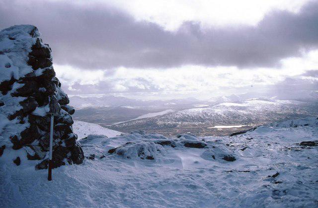
Reaching the summit, you're greeted by a substantial stone cairn, an iconic feature that marks your achievement. From this vantage point, the landscape unfurls in all directions, showcasing the sheer beauty of the surrounding Highlands. Don't forget your camera – the Instagram potential is off the charts!
Terrain
Expect a delightful variety of terrains; grassy paths, rocky outcrops, and the classic Scottish bog, which adds a bit of character (and a potential squelch!) to your hike. A sturdy pair of boots is highly recommended!
Views
The panoramic views from the summit are second to none, highlighting the expansive Loch Ericht and the towering peaks of Monadhliath, including Ben Alder in the distance. If you’re lucky, you might even catch a glimpse of Ben Nevis peeking through the clouds.
The best times to enjoy these views are late spring and early autumn, when the weather tends to be clearer and the colours more vibrant.
Hazards
While the trek is generally manageable, be aware that paths can be slippery and muddy, particularly after rain. The weather can change faster than you can say, “Is it supposed to rain?” so always check the forecast before setting off.
Access
Parking is available in Dalwhinnie, with space for about 10-12 vehicles. It’s advisable to arrive early to snag a spot, especially on sunny weekends. The village is also accessible via train, making it a convenient option for those without a car.
Facilities
Dalwhinnie has a delightful café serving up delicious home-baked treats, perfect for fuelling up before your hike or rewarding yourself after conquering Meall na Meoig. Public toilets are also available in the village, ensuring you’re well-equipped before hitting the trail.
History
The name Meall na Meoig, meaning 'Hill of the Breast', is thought to be a nod to both the shape of the hill and its links to local folklore. The area is steeped in history, with various tales and legends associated with the stunning landscape.
In conclusion, Beinn Pharlagain - Meall na Meoig is not just a mountain; it’s an adventure waiting to happen! Whether you’re a seasoned hiker or a novice looking to get your boots muddy, this Munro has something for everyone. Happy hiking!
Explore routes near Beinn Pharlagain - Meall na Meoig [Meall na Meoig]
Walks starting near this hill. Open a route to check its map, distance and full itinerary.
Killin: Falls of Dochart, Finlarig and Moirlanich Longhouse
View route
Ben Nevis via Mountain Path
View route
Banavie to Glen Loy Aqueduct: Neptune’s Staircase Canal Towpath
View route
Kenmore: Drummond Hill Black Rock Trail above Loch Tay
View route
Route planning notes
These notes describe possible approaches. Check a route's map and access information when planning your walk.
Circuit from Dalwhinnie
A scenic circuit starting from Dalwhinnie, where you'll meander through heather-covered hills and alongside crystal-clear streams before ascending to the summit.
Make a day of it, together
Find someone to share the walk with, or organise a day out along a route you like.
Photo Gallery
View all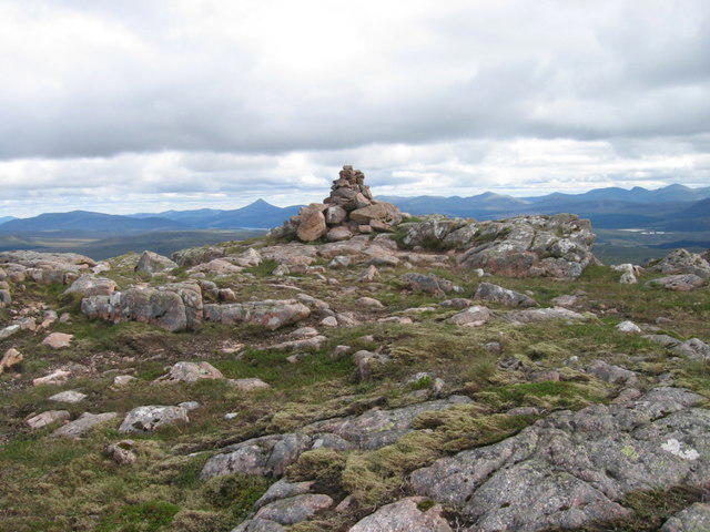 Photo could not load
NN4464 : Meall na Meaoig cairn
Chris Wimbush
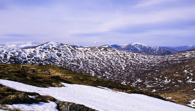 Photo could not load
NN4464 : Snow patch below summit of Meall na Meoig
Trevor Littlewood
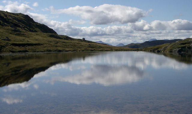 Photo could not load
NN4464 : Lochan, Meall na Meoig
Alistair Nixon
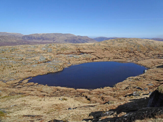 Photo could not load
NN4464 : Lochan on Meall na Meoig
Adam Ward
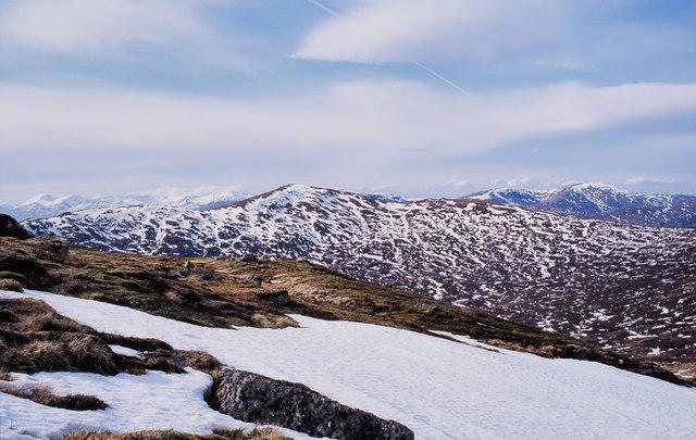 Photo could not load
NN4464 : Shelf below summit of Meall na Meoig
Trevor Littlewood
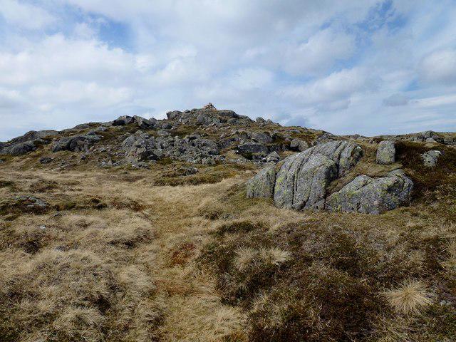 Photo could not load
NN4464 : Meall na Meoig of Beinn Pharlagain
Rude Health
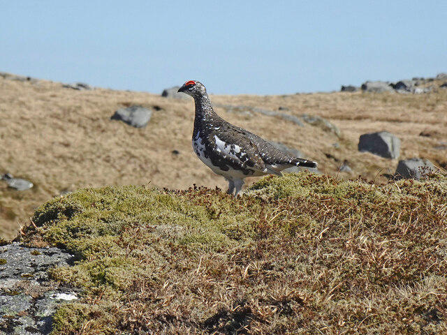 Photo could not load
NN4464 : Male Ptarmigan
Adam Ward
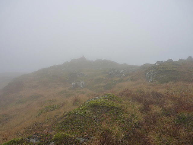 Photo could not load
NN4464 : Summit area on Meall na Meoig
Richard Law
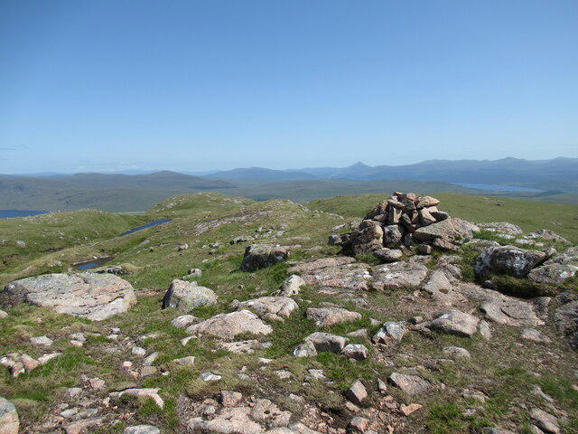 Photo could not load
NN4464 : Cairn on Meall na Meoig
Alan O'Dowd
NN4464 : Summit cairn on Meall na Meoig
Russel Wills
Hill facts and local notes
Classifications
Elevation
867m
2,845 ft
Prominence
192m
Coordinates
56.7436, -4.5390
NN448642
OS Map
42
Explorer: 385E 385W
At the Summit
The summit features a large stone cairn, which is a welcome sight after a rewarding ascent. The panoramic views stretch across the rolling hills and valleys, showcasing the wild beauty of the Highlands.
Terrain & Geology
The area is primarily composed of Old Red Sandstone, giving rise to fascinating geological formations and rich red hues in the rock faces. The gentle slopes are interspersed with rugged outcrops, making for a visually striking hike.
Views & Scenery
From the summit, you can see the expansive Loch Ericht and the impressive peaks of the surrounding Monadhliath mountains, including Ben Alder and the distant Ben Nevis on a clear day.
History & Heritage
Name Origin
Meall na Meoig translates to 'Hill of the Breast', possibly referring to the shape of the hill or its feminine attributes in local folklore.
Historical Significance
This area has been prominent in traditional Highland culture, with local stories and legends connected to the landscape, making it a significant site for both natural beauty and cultural heritage.
Getting There & Facilities
Parking
There is a small parking area at the start of the route in Dalwhinnie, accommodating about 10-12 cars. Arrive early, particularly on weekends, as space fills quickly.
Public Transport
Dalwhinnie is served by a train station on the Highland Main Line, making it accessible for those using public transport. The station is a short walk from the parking area.
Nearby Facilities
A lovely café in Dalwhinnie offers refreshments and excellent home-baking, perfect for a pre-hike coffee or post-hike treat. Public toilets are available in the village.
Safety Information
Known Hazards
- Muddy paths during wet weather and the risk of sudden weather changes. Always be prepared and check forecasts before heading out.
General Safety Tips
- Check weather conditions before setting out
- Carry appropriate clothing and equipment
- Let someone know your planned route
- Take a map, compass, and GPS device
- Carry emergency supplies: food, water, first aid kit, torch
Hills
Some common questions about the hills answered
Are there group walks up Beinn Pharlagain - Meall na Meoig [Meall na Meoig]?
Many walkers use Walkmates to join or organise walks with others. You can check for group walks around Beinn Pharlagain - Meall na Meoig [Meall na Meoig] through the maps
Are there other walkers around Beinn Pharlagain - Meall na Meoig [Meall na Meoig]?
Activity varies by location and time, but Walkmates lets you see whether others have shared walks or shown interest in this area. Find other people through the walking friends search walking friends for Beinn Pharlagain - Meall na Meoig [Meall na Meoig] search or of course create your own walk for Beinn Pharlagain - Meall na Meoig [Meall na Meoig]
Can I organise a walk to Beinn Pharlagain - Meall na Meoig [Meall na Meoig]?
Yes. If there aren’t any walks listed already, you can create a walk and make it available for others to join.
If you're signed up to Walkmates, you can create a walk to Beinn Pharlagain - Meall na Meoig [Meall na Meoig].
How do I find a walk up this hill?
There are often multiple ways to walk this hill, depending on experience and route preference. Walkmates helps you explore walks and routes that others have shared.
Can I suggest a new route up Beinn Pharlagain - Meall na Meoig [Meall na Meoig]?
Yes. You can suggest or create routes to share with others. Walkmates focuses on the social side of walking, so routes are used to help people organise walks and explore areas together, rather than as detailed navigation tools or route libraries.
Other uses really appreciate knowledgeable walkers sharing their routes. Share your favourite route to Beinn Pharlagain - Meall na Meoig [Meall na Meoig] here
The is an error or something incorrect about this hill. How do I let you know?
We always strive to keep the information on Walkmates as accurate as possible. If you find an error, please let us know through the contact form and we'll aim to correct it as quickly as possible
Community Discussion
Comments
Location
![Beinn Pharlagain - Meall na Meoig [Meall na Meoig] location map](https://cdn.walkmates.com/hill-maps/hill-sources/374/56.74362_-4.53900.png)
Grid reference: NN448642
View on OpenStreetMapOpens a map in a new tab, centred on the hill.
Nearby Hills
Ben Alder
1,148m
Creag Meagaidh
1,128m
Beinn Dorain
1,076m
Stob Ban
977m
Stob Choire Claurigh
1,177m
No comments yet. Be the first.